
Sanitation and Pluvial networks have been developed throughout Europe over several centuries. Even some cities such as Rome preserve sections of their networks built in Roman Empire times. This means that the Water Companies that operate these networks are often unaware of the layout and characteristics of 100% of them, so construction or design errors cannot be corrected and cause deficiencies in rainfall evacuation and localized flooding events. .
It is not infrequent that some sections of the network lack sufficient slope, the necessary diameter, that their materials are defective or obsolete and generate leaks, that there are wells hidden by the asphalt or that they do not adequately perform their function of collecting the contributions of different pipes.
Works done
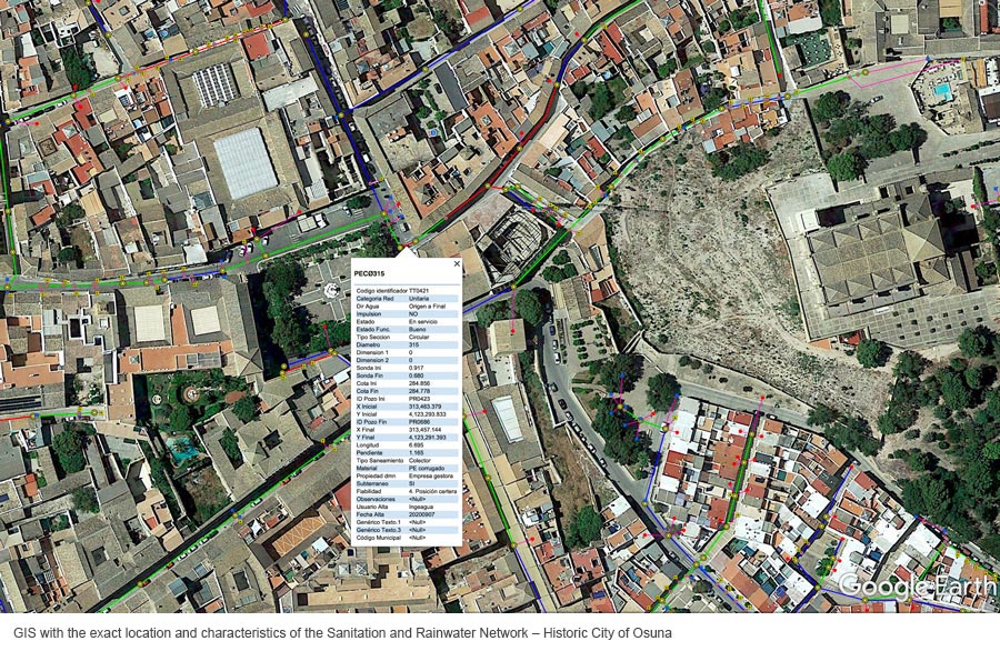
ARECIAR progresses according to the Plan approved in AA-FLOODS in the tasks of topographic survey and construction of the GIS cartographic base of the Sanitation Networks of the pilot cities of the project.
Throughout 2021, the 3D maps of the unitary Sanitation and Stormwater Evacuation networks of the towns of Osuna, Cañada Rosal and Isla Redonda have been completed, and work has begun in Écija.
This work is essential for cities to improve their capacity to evacuate torrential rains, and thus avoid flooding in the basement of houses or in neighborhoods located at the lowest levels, caused by runoff of rainwater.
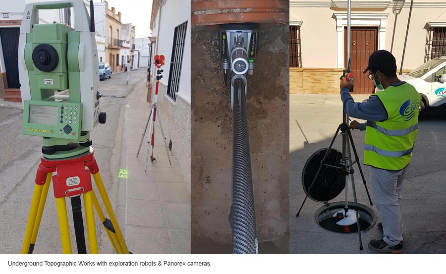
ARECIAR is using the latest topography and exploration technologies, including robots that collect data in underground sections that cannot be accessed with classical techniques. With the data obtained, ARECIAR plans its next investments to improve the efficiency of the network, and other AA-FLOODS Project partners, such as the University of Coruña, are being able to model the behavior of different rainfall scenarios within the cities, to identify the points in that an intervention is urgent.
In 2022 and 2023 these analyzes will allow the application of Nature-Based Solutions in the future Urban Planning of these Pilot cities: drainage pavements, design of green areas that mitigate runoff, etc… within the framework of the AA-FLOODS Project recently expanded by the Interreg Atlantic Area Program.
European-wide impact
With these actions, it will be possible to prepare Methodological Reports that serve as a Guide to improve the design of urban drainage and rainwater networks applicable to any city in the European Union, in which costs and benefits will be analyzed and the techniques used for both the cartography and for its exploitation will be explained in detail for the benefit of mitigating the effects of Climate Change.


