The high-precision 3D mapping works of Work Package 5 have been completed and are available for partners and associate partners of the AA-FLOODS Project to serve as a basis for other activities of Work Packages 4 and 5.
Works done
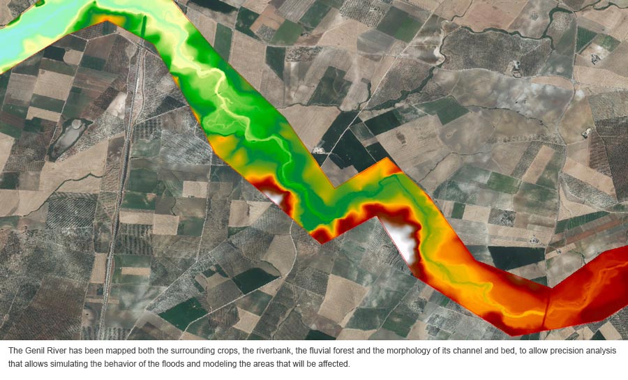
During 2021, the Cartography works have been carried out by the Regional Ministry of Agriculture, Livestock, Fisheries and Sustainable Development of Andalusia in Pilot Areas 1 and 2 in the Genil River lower sub-basin.
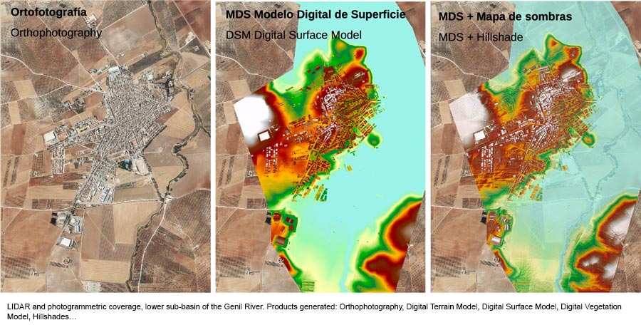
LIDAR technology is based on emitting a series of laser pulses on the ground from an airborne sensor to obtain a cloud of points with coordinates x, y, z to build with them high-precision maps (up to 10cm accuracy). These maps are especially relevant to analyze what impact the floods will have: which areas will be affected and how the flood will behave depends on the shape of the terrain.
To the LIDAR work, a field correction has been added for the most complex elements that affect the flooding of the Genil River, such as bridges or irrigation low dams, in which the LIDAR sensor could encounter shadow areas, and which have been surveyed using topographic techniques.
To finish, an enormous work of underwater mapping or bathymetry has produced a 3D map of the Genil river bed, since the morphology of the river is a determining factor for the behavior of the currents at times when the flow rises vertiginously, and determine (together to the configuration of the banks and the land neighboring the river) the exact points where the river will overflow, and how the fields and cities will be flooded.
Impact on a European scale
LIDAR data has been captured with a precision more than 30 times higher than the standard used in Spain to date, to generate maps and Digital Terrain Models with 17 laser points per square meter (when the 2019 National Plan for Aerial Orthophotography reached 0.5 points per square meter).
The objective of this work is to improve the accuracy of Risk Maps and Hazard Maps by combining surface and bathymetric LIDAR with state-of-the-art modeling software to simulate water flow, and to evaluate the transferability of this new methodology based on of its costs and results to the rest of the EU.
Preliminary analyzes indicate that due to economic costs (which are moderate) and due to the necessary territorial, hydrological and hydraulic analyzes (which are complex), this methodology is applicable in large river areas of the EU and will be especially indicated for the most conflictive points and for those in which it is necessary to evaluate the application of Nature-based Solutions.