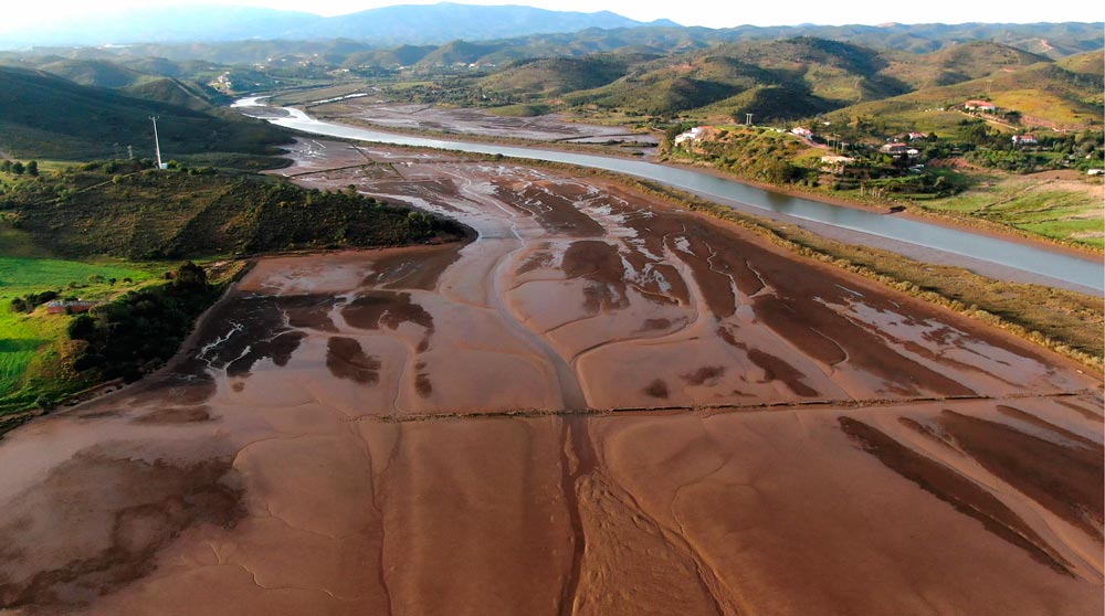
Odelouca & Arade rivers 3D LIDAR Mapping

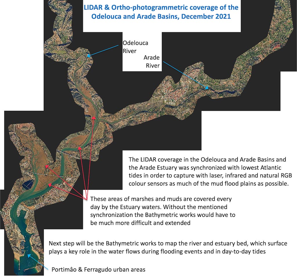
The high-precision 3D mapping works of Work Package 6 are underway and the capture and processing of the maps obtained with airborne LIDAR technology has already been completed. These works have covered the basins of the Odelouca and Arade rivers from their reservoirs closest to the Algarve Coast, as well as the Arade estuary and its outlet to the sea in Portimâo.

PROJECT AA-FLOODS au Algarve. Águas do Algarve

Águas do Algarve participe au projet AA-FLOODS dans le but d’améliorer la prévention et la gestion des urgences liées aux inondations. Dans ce reportage vidéo, la vice-présidente Mme Isabel Soares explique le problème du changement climatique en Algarve, le problème des inondations et des sécheresses, le rôle de l’entreprise publique Águas do Algarve dans le … Lire la suite