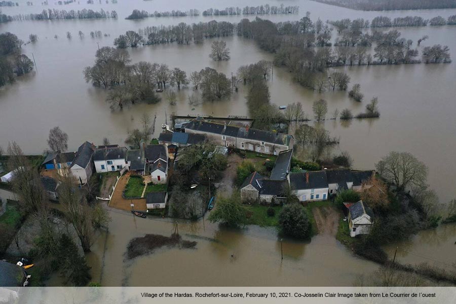
In the French Pays de la Loire region, where AA-Floods partner Université de Nantes is located, heavy rains in early- to mid-February caused flooding or evacuations due to flood risk in the towns of Ancenis, Rochefort-sur-Loire, several towns in the Vendée department, and towns in the wetlands southwest of Nantes, among others. Warnings issued on February 4th by MétéoFrance for the river Loire reached their second-highest level, orange, a national flood warning procedure implemented to meet the 2007 European Flood Directive. Thankfully, despite the flooding and damage, there were no deaths recorded in this period.
Like all major flooding events, this offers us an opportunity to view flood policy in action. In France, known flood-prone areas are categorized as Territoires à Risques Importants d’inondation (TRIs). TRIs in Pays de la Loire are shown in the map below in cyan:
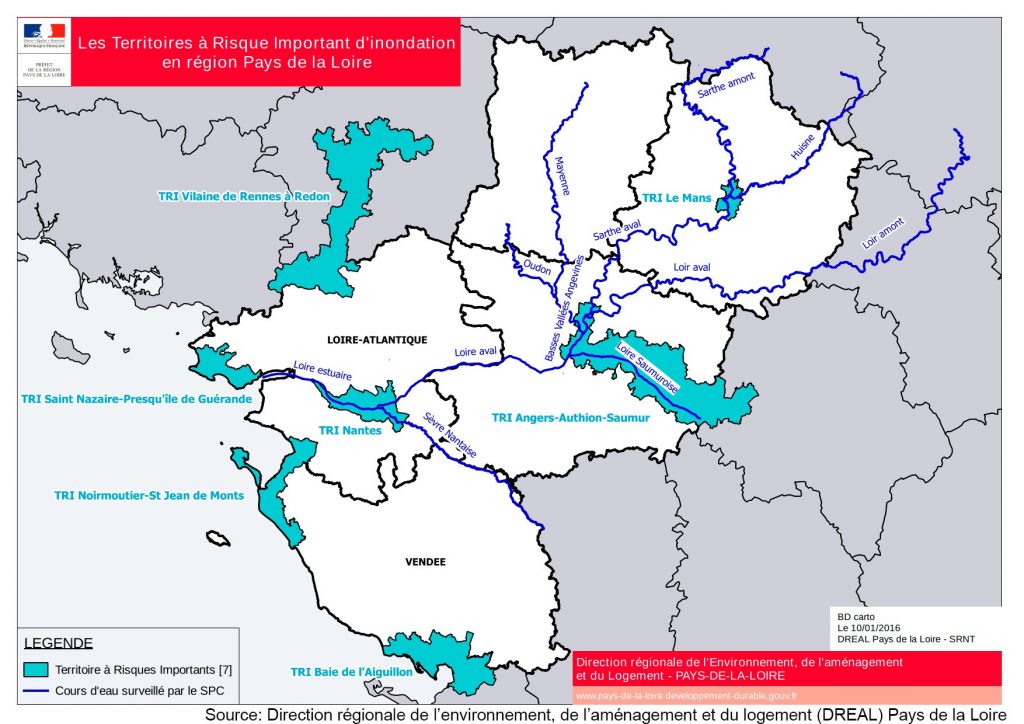
TRI identification is based on national criteria for assessing what constitutes high risk. The criteria consider a combination of risk of hydraulic inundation and potential human and economic damages. As such, much of the flooded and identified risk areas fell outside of Pays de la Loire TRIs in this case. However, we can consider examples of how the identification of TRIs continued to benefit the region.
The assessment of each TRI includes identification of points of interest outside of the TRIs. For example, Ancenis, despite being approximately 25 km outside of the Nantes TRI, is mentioned in the territorial assessment due to having two integrated pollution prevention and control (IPPC) installations within 30 km of the TRI border. An IPPC designation indicates a facility with a high capacity for pollution. Notably in the case of potential for river pollution, Ancenis is upstream of the Nantes TRI and located along the same principal waterway (River Loire).
Additionally, a very practical benefit of TRI assessment is it triggers development of local flood risk management plans, called Stratégies Locale de Gestion des Risques d’Inondation (SLGRIs). These SLGRIs detail flood response strategies for the protection and care of local populations and economic interests. As noted in the SLGRI for the Nantes TRI, “Note that some SLGRI actions also concern territories extending outside the borders of the TRI.” This is evident as the flood risk in the wetlands areas south of Nantes was due to tributaries of the river Loire which is the principal waterway of concern in the TRI. So, areas near a TRI can benefit from locally focused strategies and guidance despite being outside the TRI borders.
Such an assessment of current events brings into focus the value of the flood policy assessment being conducted by AA-FLOODS. We continue our work knowing the implications of how European policy must translate to reasonable local policy. As demonstrated by one of our partners, the risks are not always far from home.
The SLGRI for the Nantes TRI and other flood information is available on the Loire-Atlantique department website:
The risk mapping report for the Nantes TRI is available from Direction régionale de l’environnement, de l’aménagement et du logement (DREAL) Pays de la Loire:


