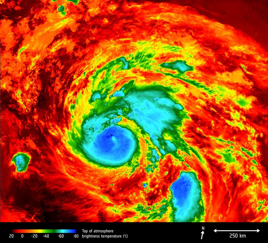
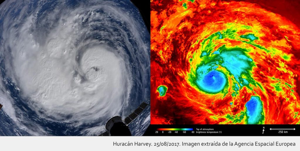
The scientific journal Nature has recently published an article under the title Measuring inequality in community resilience to natural disasters using large-scale mobility data[1]. In it, a team of researchers – Boyeong Hong, Bartosz J. Bonczak, Arpit Gupta & Constantine E. Kontokosta – have developed a generalizable method that uses large-scale Smartphone geolocation data to measure and evaluate the response and recovery neighborhoods from natural disasters. To implement the method, the have used information from Hurricane Harvey that took place in August 2017, leaving the city of Houston (Texas) devastated. This hurricane has been considere dan unprecedented flood event in 1000 years and the second costliest disaster in US history.
The study has analyzed the geolocation data of more tan 800.000 mobile devices or smartphones during a period of 2 months (August 1, 2017 to September 30, 2017) tha covers ≈ 1 million unique users in Houston, equivalent to ≈ 35% of the total population of the metropolitan área. And the resilience of the community has been measured and studied by estimating variations in the mobility patterns of residents as an indicator of human behavior and social activity, a central indicator of the dynamics of the urban system, before, during and after Hurricane Harvey.
The study authors state that: Emerging sources of large-scale mobility data can be uses to model human behavior in response to natural disasters. Accurate assessment of the spatio-temporal mobility patterns of people in cities could provide new insights into many urban planning and operational decisions, such as traffic forecasting, resource allocation, crisis and outbreak prediction, and management disaster. By extensión, the application of geotagged big data in this context can lead us towards more robust and validated urban dynamics models that can begin to account for the unique socio-ecological complexities of the urban environment.
 The researchers consider that despite the fact tha mobility data are used in disaster management, they have not been barely taken into account to obtain patterns that help evacuation and recovery at the neighborhood level with different and even divergent socio-economic and demographic characteristics.
A new perspective on behavioral response to disasters emerges from this study and provides the basis for data-driven public sector decisions that prioritize equitable resource allocation to vulnerable neighborhoods.
[1] https://www.nature.com/articles/s41467-021-22160-w


