The new technological resources that we have available on our mobile devices, especially virtual reality and augmented reality, allow us to disseminate relevant and useful information to a greater number of recipients, and to raise awareness on topics of general and particular interest. Accessibility to that information is key:
- The channel used and how it is presented is essential to be understandable by a non-expert audience.
The Environmental Engineering and Water Research Group (GEAMA), of the University of A Coruña, which participates as a partner in the AA-FLOODS Project, has prepared the following informative video in which it shows how the coupling between different techniques, a modeling Numerical 2D with Iber and an Augmented Reality SandBox, can serve to prevent the risk of floods, and adapt to it through a pedagogical bet useful even for educationa purposes.
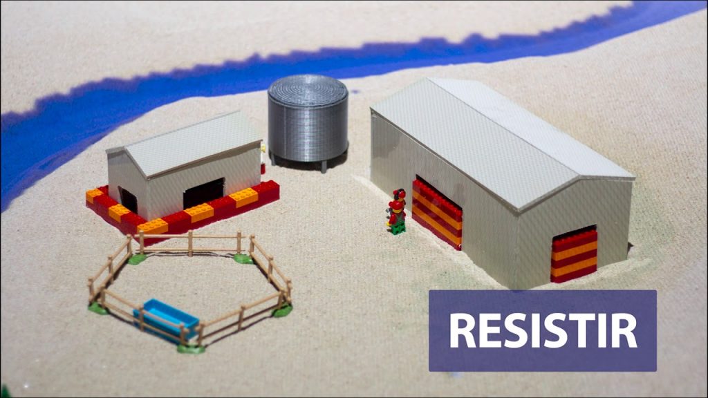
In a recreation with Lego constructions, it is shown how we can prevent and/or reduce the consequences of a flood in a farm, and how to calculate the posible losses in case this event occurs, so that it can be valued in monetary terms at what we face it if we do not become aware and assume the need to implement corrective and preventive measures.
As this Research Group explains:
… Augmented reality models are an accesible way to explain to a non-technical audience the effects of floods and what kind of measures can be taken to diminish their negative effects. They can also be used to explain to communities the positive effects of new flood protection measures. Visualizing a flood in an augmented reality model is much more intuitive than looking at flood maps or technical results. An augmented reality model can be very easily adapted to show people that are not familiar with flood risk concepts, how flooding may affect their home or business, and what measures can be taken to protect them.
The GEAMA researchers describe what this augmented reality installation consists of:
…It consists of a sandbox into which a specific topography, as well as other elements as buildings, roads or dikes, can be incorporated. A scanner generates a Digital Terrain Model (DTM) from the sandbox topography, while hydraulic and hydrological parameters can be defined with a simple GUI. These data is used to simulate overland flow in real time, using the hydraulic software Iber+. Quantitative results of flood extension and magnitude are represented directly over the physical topography, yielding a realistic 3D visual effect. This installation is conceived for both educational and professional uses.
AUGMENTED REALITY becomes a very useful pedagogical tool to inform and sensitize citizens about floods, some of their consequences and possible measures that can prevent and mitigate their effects.


