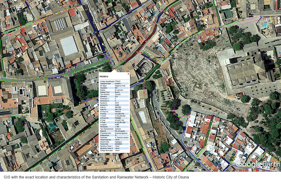
Underground 3D Mapping of unitary Sanitation and Rainwater networks
ARECIAR progresses according to the Plan approved in AA-FLOODS in the tasks of topographic survey and construction of the GIS cartographic base of the Sanitation Networks of the pilot cities of the project.


